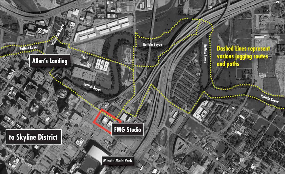
Aerial view showing my downtown Houston Studio (bordered in red) at Crawford and Commerce Streets. Yellow dashes indicate Buffalo and White Oak Bayou path access.
I can only imagine what must be beneath the soil, along the banks, beneath the criss-crossing Interstate Highway overpasses, under the office towers and parking lots and beneath the bayou when I take my frequent runs or when I walk the dogs.
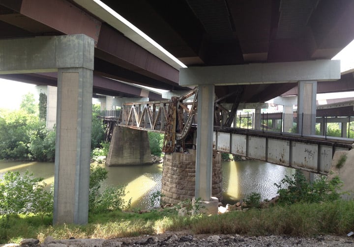
My paths take me along the sleepy Buffalo Bayou that leads to the Houston Ship Channel and eventually the Gulf of Mexico. Long forgotten railroad bridges are covered up by a web of Interstate Highway overpasses.
The Paths
 I started a series of posts a few months ago (see below links) to sort through some local material that I have mentally and digitally gathered over time and to inspire myself to look closer at the history beneath my feet and all around me here in downtown Houston. My studio offices here at FMG Design are so close to Buffalo Bayou and Allen’s Landing where Houston got its start. I can only imagine what must be beneath the soil, along the banks, beneath the criss-crossing Interstate Highway overpasses, under the office towers and parking lots and beneath the bayou when I take my frequent runs or when I walk the dogs.
Read: Allen’s Landing – Houston (not everything is new here) – Part I
Read: What was here, Early Houston Advertisements – Part II
Read: What was here, Early Houston Advertisements – Part IIA
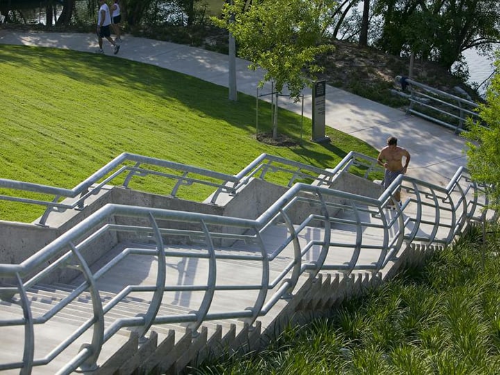
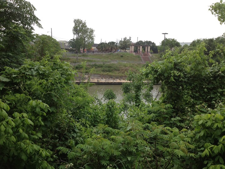
Newer areas of path development along the Sabine Street Bridge and Buffalo Bayou.
You can see my studio offices in the red rectangle in the top aerial plan and the early photograph below of the Eller Wagon Works bulding. My particular studio office is beyond the three corner windows in front of the people posing. I use the yellow dashed connector paths in the map above to avoid the roadways and to hug the bayous.
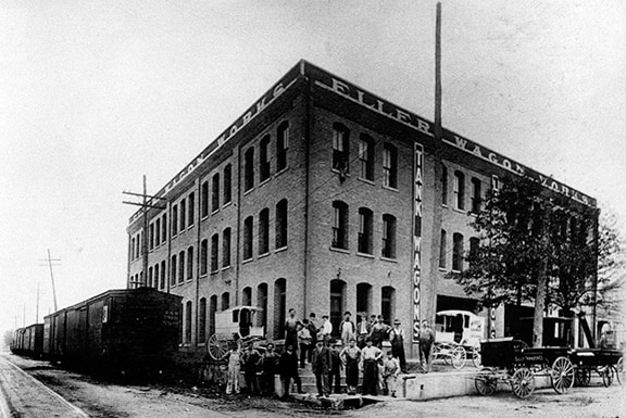
Eller Wagon Works Building – FMG Design studio – Corner of Crawford and Commerce Streets, Houston, Texas
Inspirational E-mail
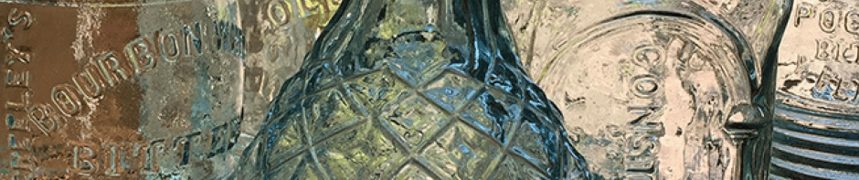
A couple of years ago I received this really neat e-mail from Floyd Boyett (read below) that got me thinking. I mean, why was this killer Best Bitters in America from Kalamazoo, Michigan found in the mud of Galveston Bay?
Read: Is the Best Bitters in America the Best Bitters in America?
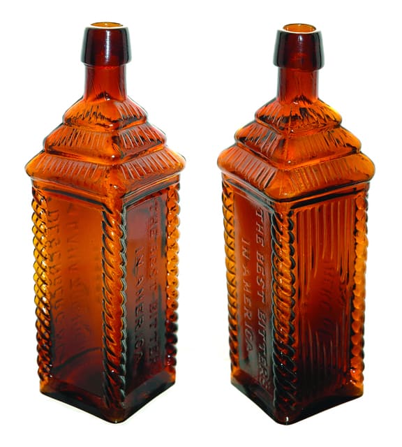
Best Bitters in America – Meyer Collection
Ferdinand,
I started collection bottles as a young family man in 1969 while living in Houston, Texas. While participation in on of the earliest Gulf Coast Bottle and Jar Club shows a young black fellow came in with a box of bottles. I was one of the first to see the bottles as they came out of his box. Among the bottles that he had found in the mud of Galveston Bay was two badly broken Best Bitters in America and one near mint example. I bought the good one as fast as I could get my money out and have kept it in a sock and metal box ever since. I have never seen one come up for sale. How many do you know about? Thanks for posting the info on this great bottle.
My main interest was in cures and I got to visit with Dr. Sam Greer and Bill Agee many times.
Floyd Boyett
Lumberton, Texas
Buffalo Bayou An Echo of Houston’s Wilderness Beginnings – G&HJ Railroad – a short line with a long history by Louis F. Aulbach
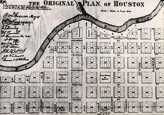
The Original Plan of Houston
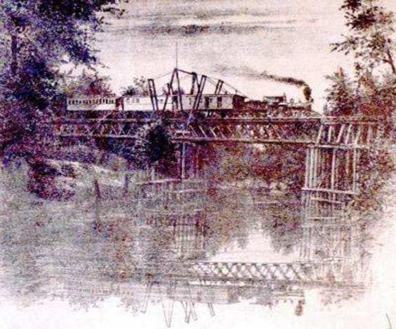
The G&HJ railroad bridge over Buffalo Bayou as depicted on the Wood map of 1869 – Buffalo Bayou – An Echo of Houston’s Wilderness Beginnings by Louis F. Aulbach
“Houston, where 17 railroads meet the sea” used to be the slogan of the Houston Chamber of Commerce.
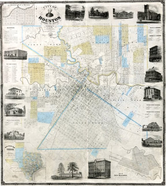
Houston Street Map – 1869
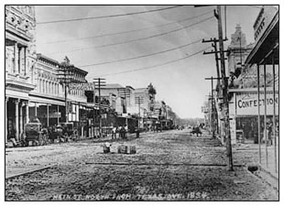
Main Street & Texas Avenue
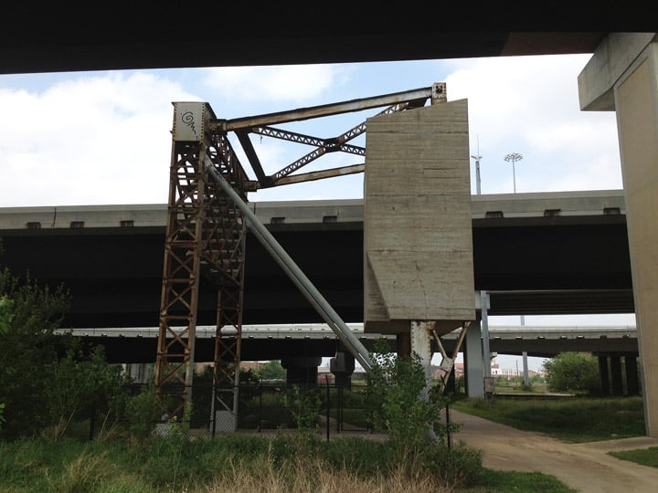
A giant old counter balance used for a railroad draw bridge. Path is on the right under the freeways. The Buffalo Bayou is on the left.
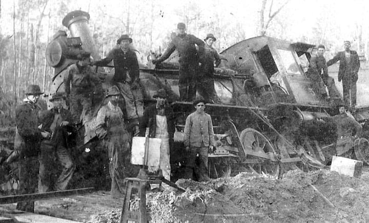
Workers posting at Locomotive wreck at 4C Mill
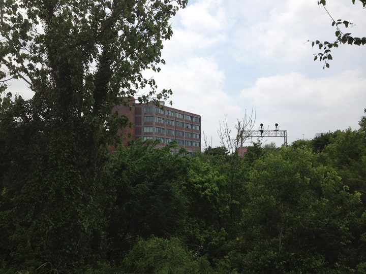
Old warehouses and industrial buildings once lined Buffalo Bayou. I can see the old foundations covered in brush like an old Mayan city. Some of the buildings have been converted to contemporary lofts.
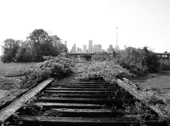
Houston Skyline, from Old MKT Railroad Trestle over White Oak Bayou, near Studemont & I-10, Houston, Texas
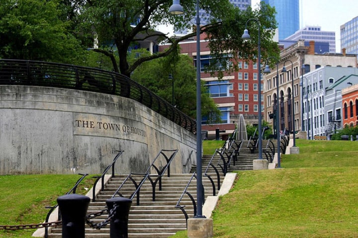
Developed path from Allen’s Landing up to Main Street. We almost purchased one of the historic buildings in the upper right for FMG Design. Parking was a problem.
The paths overlook raw banks along Buffalo Bayou. There are so many clues as to what was on the banks before. You have to wonder about all of the bottles that were thrown in the bayou during the early Houston boom days.
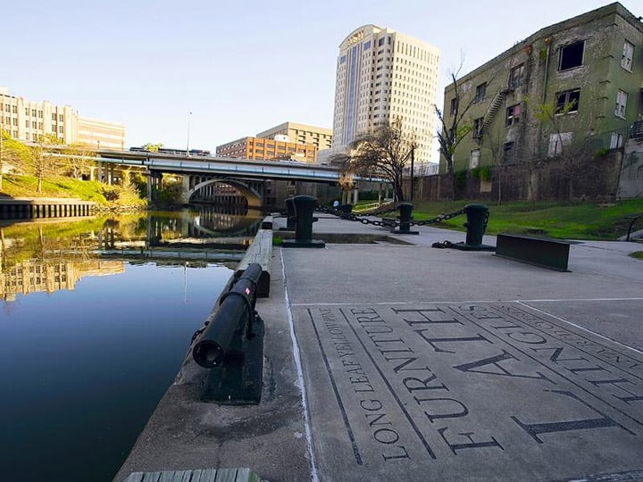
Allen’s Landing now
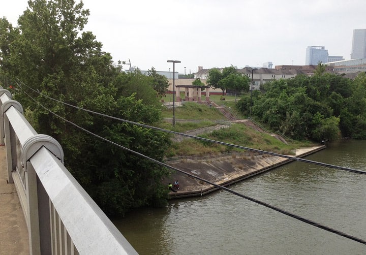
Two guys fish beneath the Jensen Street bridge.
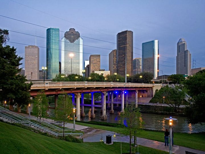
The gorgeous Houston skyline.
I imagine that there are crates of long forgotten Lacour’s, Cassin’s and Bryant’s Stomach Bitters covered in dirt and dust.
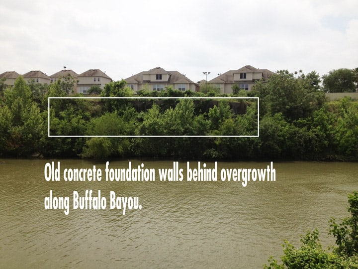
Every time I run on this path I look across Buffalo Bayou and see the growth of plants, bushes and trees in from of old warehouse foundation. During the winter, I can see two locked steel doors. I imagine that there are crates of long forgotten Lacour’s, Cassin’s and Bryant’s Stomach Bitters covered in dirt and dust. Man I would like to get in there.